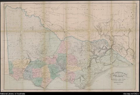
Thomas Ham, The squatting map of Victoria, Blundell and Ford, Melbourne, 1864-1865, MAP RM 1042.
This squatting map of Victoria shows counties, road and rail lines, settlements and subdivisions. Relief is shown on the map using hachures.

Thomas Ham, The squatting map of Victoria, Blundell and Ford, Melbourne, 1864-1865, MAP RM 1042.
This squatting map of Victoria shows counties, road and rail lines, settlements and subdivisions. Relief is shown on the map using hachures.
There are many maps which show the location of pastoral runs, stations and squatting ‘runs’. Most can be viewed online, others can be viewed at the Library.
1. Search the Library’s catalogue
Enter the relevant state name and pastoral or squatting (eg "New South Wales" AND pastoral OR squatting) into the search bar for the catalogue and search. Review the catalogue results and use the filters on the right-hand side to select “Map” for format. Date sort the results (oldest to newest).
2. Identify a pastoral property
Most of the early pastoral maps have been digitised. Zoom in on the map to identify pastoral properties.
3. Request to view the map at the Library
You will need a Library membership to access our special collections materials in-person. Applying for a free Library membership allows you to request collection items to use in the Library, and provides access to a wide range of eResources from home.
If the map is not digitised, it can be requested to view in the Library. To request a map, scroll down the catalogue record, "Select" the item, log in to your account and proceed to confirm your "Request".
4. Consult Bailliere’s gazetteer
Many localities and pastoral stations are referred to and described in Bailliere’s gazetteers, published for each colony in the 1860s and 1870s. These are available on request via the catalogue (eg “New South Wales” AND Bailliere’s gazetteer).
Bailliere's gazetteers for New South Wales, South Australia, Queensland and Tasmania have all been digitised and are available online from the Library of Congress.
Detail from Bailliere's New South Wales gazetteer and road guide : containing the most recent and accurate information as to every place in the colony : with map, F. F. Bailliere, Sydney 1866, Library of Congress call number 3234518.

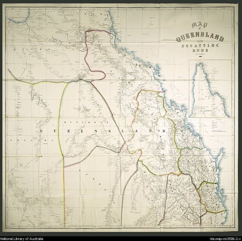
William Owen, Map of Queensland with squatting runs, 1866, H. Bolton, Lith., Melbourne, 1869, MAP RM 3596/2.
This map of Queensland shows 12 land districts, with detail of individual squatting runs. The land districts persist to this day (albeit both Gregory and Kennedy have been split into North and South).