Gazetteers are listings of places, providing information such as territorial division (county etc), location (eg latitude and longitude), alternate names, population size, etc. Some gazetteers give quite detailed descriptions of places, or the sheet numbers of relevant Ordnance Survey maps. There are many gazetteers in our collection, covering England, Ireland, Scotland and Wales at various points in time. By using historical gazetteers you can find out not only where a place was, but also some key information about that locality at a particular point in time.
Some British and Irish Gazetteers are available for reference in the Special Collections Reading Room. Others may be requested through the catalogue. Search using any of the following search terms: England AND gazetteer, Ireland AND gazetteer, Great Britain AND gazetteer, Wales AND gazetteer or Scotland AND gazetteer. Scroll down the catalogue record, select "In the Library" and then "Request this".
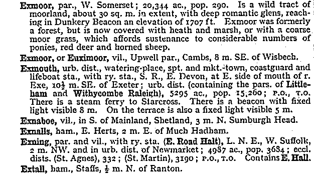
Excerpt from John Bartholomew and Son, Gazetteer of the British Isles, 9th ed., 1970, showing alphabetical listing of place names with details of each.
KEY RESOURCES AT THE LIBRARY
Cassell's gazetteer of Great Britain and Ireland (1894-98)
The National gazetteer of Great Britain and Ireland (1861)
The gazetteer of England : England's cities, towns, villages and hamlets (1972)
Gazetteer of England and Wales (1840-1843) (microfilm available)
Johnston's gazetteer of Scotland (1973)
General Index to the Townlands and Towns, Parishes and Baronies of Ireland, based on the Census of Ireland for 1851
Gazetteer of Northern Ireland, listing all the names that appear on the sheets of the 1-inch map (third series) and giving the position of each name in terms of the Irish grid. (1969)

