Find and request aerial photography of a major town or airfield
1. Search the Library’s catalogue
Enter the place name and “aerial” into the search bar, and select “Map” from the dropdown menu for format. For example, search results for aerial photographs of Cairns.
2. Use flight diagrams to identify photographs covering your area of interest
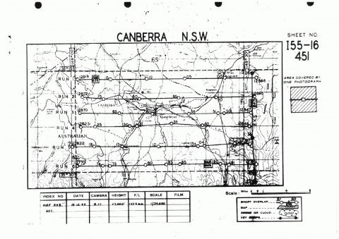
Most catalogue records for aerial photographs have a flight diagram attached. Flight diagrams show the area covered, divided into “runs”. A run is the flight path of the plane as it photographed the area below. Use the flight diagram (where applicable) to ascertain whether a particular series of photographs covers your area of interest.
If there is no flight diagram or you are unsure which photographs to request, contact Ask a Librarian for assistance.
3. Request to view the photographs at the Library
Once you have identified a group of photographs in the catalogue, you can request to view the prints in the Special Collections Reading Room. To do this, select "Request" and then "Select" on your preferred option in the catalogue record.
Please ensure you specify in the notes field exactly which photographs you would like to view, for example “Runs 3-5” or “photographs 129-136”.
